I do love maps. I love looking through atlases, even their faintly ridiculous 21st century incarnation, the e-atlas. But really, in this world we live in now — rather than that of bewhiskered gentlemen poring over suspiciously stained folios in the libraries of London clubs, motes of dust dancing in the air as each leaf is turned over and final plans are agreed for their next foray into the Heart of Darkness — what is an atlas for? Surely it is for more than just displaying the ingenuity and skill of the mapmakers? There is much ingenuity and skill on display in the new online version of the Atlas of African Agriculture Research & Development, don’t get me wrong. But what do the mapmakers think their atlas is for? I don’t think it is enough to say that there are
…plans for an online, open-access resource of spatial data and tools that will be generated and maintained by a community of research scientists, development analysts, and practitioners working in and for Africa.
If you’re going to call something an e-atlas and put it online, to much fanfare, you can’t just make the maps available for download and sharing as PDFs. That’s really no use to anyone. Take these maps on growing season length and its likely changes.
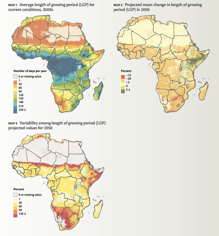
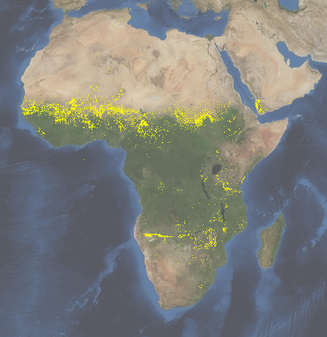
What anyone would want to do is start combining these with other data, say on — oh I don’t know, let me think — the distribution of germplasm in genebanks? Like this on pearl millet, according to Genesys.
I’m pretty sure that there must be some pearl millet landraces in genebanks somewhere with the adaptation to shorter growing seasons that we’re going to need in the sorts of places highlighted by that Map 2 from the e-atlas. And that we might find those with the help of their Map 1 and the data from Genesys (which I can donwload as a KML). But how can I be sure, when Maps 1 and 2 are only available as PDFs? ((As far as I can judge. Please do tell me I’m wrong.))
Anyway, maybe I won’t have long to wait. There are plans, after all. I don’t know, maybe the maps in the e-atlas are already available elsewhere as KMLs or shapefiles or something usable, and you just have to ask? But then, what is this e-atlas for? Nice maps, though. Lots of fun to leaf through.