The Atlantic had a feature last week on the Human Landscapes of Mexico showing Google Maps shots of different parts of the country. This kind of thing:
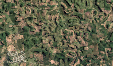
I mashed them up in Google Earth with the distribution of crop wild relatives, downloaded from Genesys. This is what I got for the environs of Guadalajara. The yellow dot is the site of the photo in The Atlantic‘s photo essay, the red circles collecting sites, mostly of wild beans.
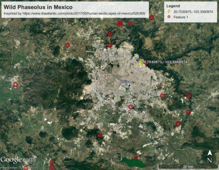
Good thing those populations are in genebanks.
This particular area of the state of Jalisco is part of the proposed Mesoamerican center of domestication of common bean (Kwak et al. 2009 Crop Sci.).