- CIP’s high-tech genebank.
- “The project’s eventual aim is to plant several thousand trees at sites across Perthshire to act as a ‘living gene bank.'” What, because normally genebanks are dead?
- Millennium Seed Bank joins ICRAF’s BusyTrees thing. Which you can follow in about a million different social networking ways.
- Conservation Magazine does a number on crop improvement. Wait, what? Conservation Magazine? Yep, and with teaching resources.
- Fenugreek, barkeep, and make it a double.
- Ancient chocolate and corn routes.
- What species distribution models do you like?
Wallow Fire (may) threaten (some) wild beans. Maybe.
There’s a really bad fire spreading in Arizona. 1
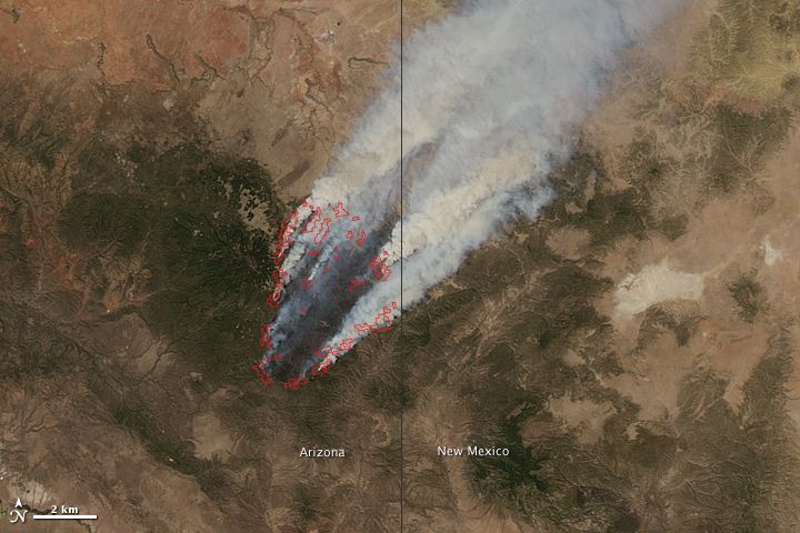
You can donwload all kinds of stuff about it, and even post your experiences of it on Facebook. But can you find out whether any crop wild relatives are threatened by it? Well, sure: all you have to do is go off to GBIF, and choose a likely genus (Phaseolus, say), and download the records, and mash them up in Google Earth with the latest fire perimeter data or whatever. 2 Like I’ve done here:
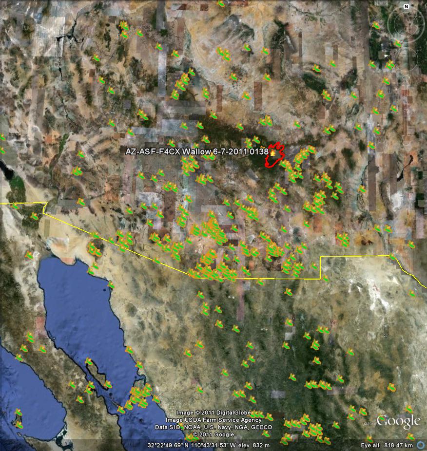
Coming in closer, and using the NASA GeoTIFF instead of the normal Google Earth imagery, you can put yourself in the position of being able to make some reasonably intelligent guesses about what might be happening to some of these populations, and the genepool as a whole in the area:
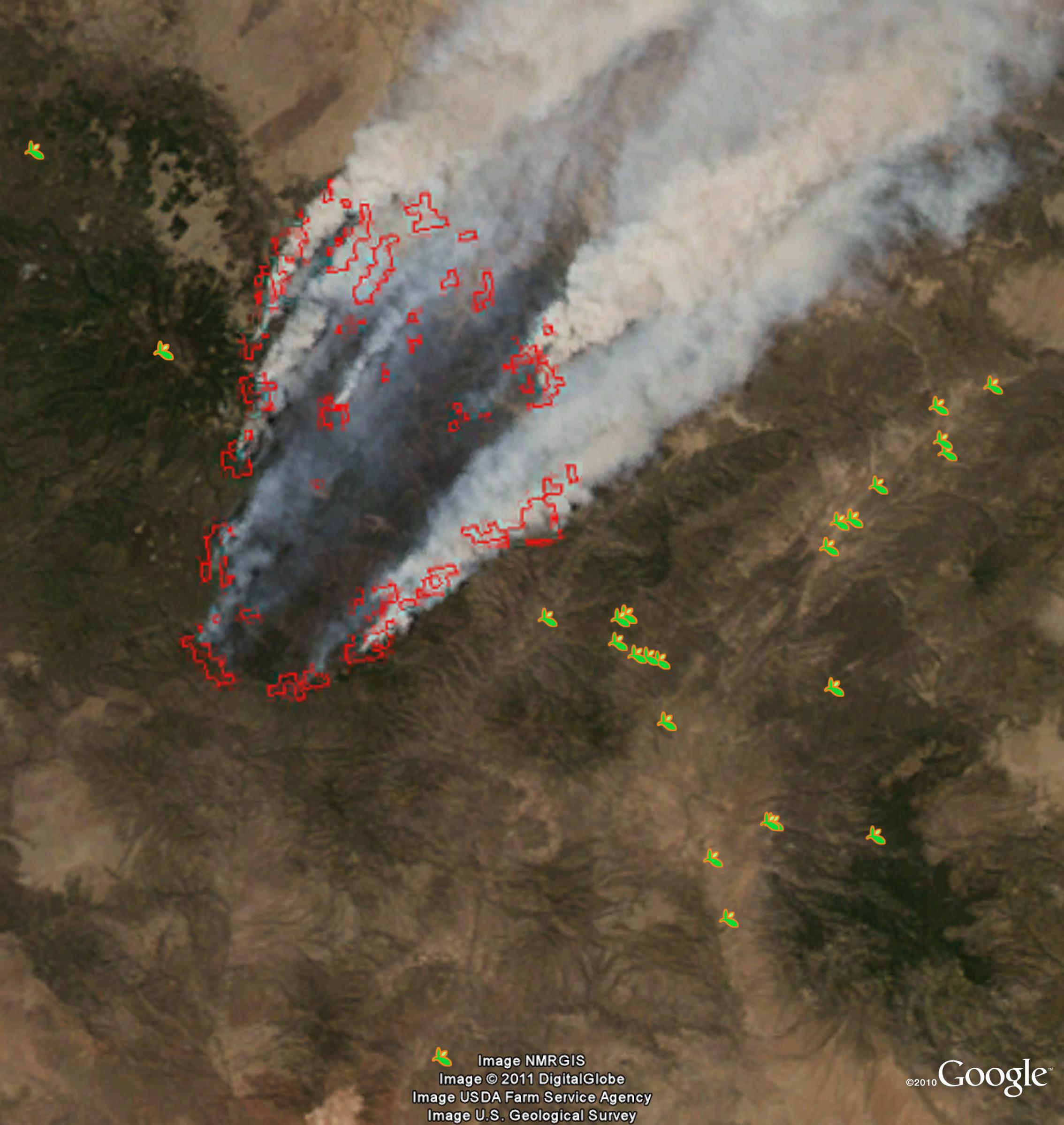
But what I really meant is that there ought to be a way to do this automagically, or something. Anyway, it is sobering to reflect that while all hell is breaking loose in Arizona, not that far away to the northeast, in the peaceful surroundings of the Denver Botanical Garden, Anasazi beans are enjoying their day in the sun, utterly oblivious of the mortal threat faced by some of their wild cousins. It’s a cruel world. And there’s a point in all this about the need for complementary conservation strategies that’s just waiting to be made. Isn’t there?
More on visualizing collecting localities
Clearly short of something to say after the almighty media circus generated by the climate change hotspots publication, our friend Andy Jarvis is reduced to celebrating an embarassingly artificial milestone on the DAPA blog today. Normally I would treat such awkward space filling with the contempt it deserves, but today I’m in the mood to, well, fill space. So here goes.
Andy’s post is about the 90m-resolution digital elevation dataset he and his colleagues have been working on for ages. The milestone he trumpets is 750,000 visitors, but more important is the fact that the data is now visible in Google Earth, which I didn’t know. Here’s what a bit of Spain looks like with the normal Google Earth imagery, the records on show being from Genesys. 3
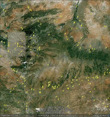
And this is what the same area looks like using the SRTM data:
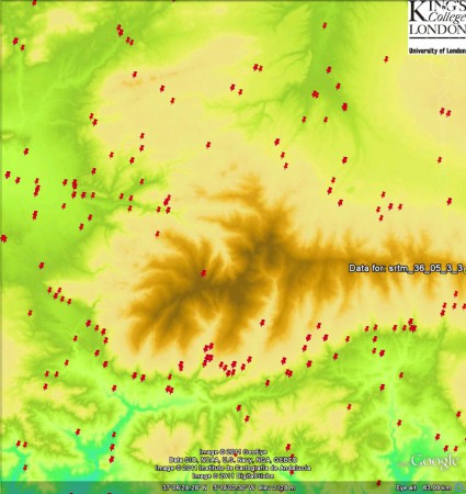
Advantages to both, I suppose, from a purely aesthetic point of view.
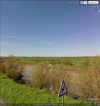
Incidentally, some further playing around with Google Earth revealed a couple of collecting localities for Beta maritima (from GBIF this time) that are easily visible in Street View. Here’s an example, featuring a record from France’s Inventaire national du Patrimoine naturel (INPN), catalogue number INPN_21204166 in case you’re interested. 4
Brainfood: Cabbages, Crops in Darfur, Sowing dates, People and biodiversity, Honeybees, Rhizobium, Figs, Urban ag, Wild olives, Ancient textiles, Ducks, Wheat introgression, Food citizenship, Crop models, Trifolium, Variety choice
- Genetic diversity of Brassica oleracea var. capitata gene bank accessions assessed by AFLP. Czech genebank; subgroups reflected place of origin.
- Optimizing the cropping mix in North Darfur State, Sudan. A study of Umkdada district. “…the results of the model were different from the real practices of the farmers.” Oh dear. To improve the fit, schoolboys should work in the fields more. And crops should fetch more. The dismal science indeed.
- Climate-driven simulation of global crop sowing dates. Ok, this model works. You can predict sowing dates under rainfed conditions for various annual crops from climatic conditions. Not entirely sure why you would want to, though.
- Exploring some of the myths of land use change: Can rural to urban migration drive declines in biodiversity? Yes, counter-intuitively, at least in the forests of Mexico’s southwestern highlands. More from Conservation Magazine.
- Pollination services in the UK: How important are honeybees? Quite a bit, but maybe not as much as previously thought. It’s the wild bees, stupid!
- Genetic diversity and symbiotic effectiveness of rhizobia isolated from root nodules of Phaseolus vulgaris L. grown in soils of Iran. It is high, and it varies, respectively.
- Interspecific hybridization of fig (Ficus carica L.) and Ficus erecta Thunb., a source of Ceratocystis canker resistance. It’s a breakthrough!
- Exploring the diversity of urban and peri-urban agricultural systems in Sudano-Sahelian West Africa: An attempt towards a regional typology. There are 6 types. Not 5; not 7. On this one, the journey is more interesting than the destination.
- Variability of wild olives (Olea europaea subsp. europaea var. sylvestris) analyzed by agro-morphological traits and SSR markers. There’s a lot of variabzzzzzzzzzz…
- Hemp in ancient rope and fabric from the Christmas Cave in Israel: Talmudic background and DNA sequence identification. Mainly flax, but some hemp, from both Roman and Chalcolithic periods. But can you smoke it?
- Modelling the distribution of domestic ducks in Monsoon Asia. Low resolution data, plus fancy modelling, can be used to get pretty good high resolution predictions.
- Gene flow between wheat and wild relatives: empirical evidence from Aegilops geniculata, Ae. neglecta and Ae. triuncialis. It happens, a lot.
- Toward food system sustainability through school food system change: Think&EatGreen@School and the making of a community-university research alliance. Food citizenship?
- Simulation of winter wheat yield and its variability in different climates of Europe: A comparison of eight crop growth models. Big differences among models, so best thing to do is to use the mean of all of them.
- The potential of plant viruses to promote genotypic diversity via genotype × environment interactions. The negative effect of White Clover Mosaic Virus (WCMV) infection on performance differs from white clover genotype to genotypes, which means differential selection, which means negative frequency-dependent selection in host populations, which means diversity. Via.
- Amplifying the benefits of agroecology by using the right cultivars. Why should we summarize, when an author has already done so?
More pain
Don’t get frustrated, there is always hope! We have now included the possibility of directly downloading the map of the recommended locations for genetic reserves in kmz, shp and tiff formats in the main webpage. This website is focused on the dissemination of information to the general public. For those interested in more detail, the webpage of each proposed site provided links to protectedplanet.net or Natura 2000 viewer where additional information concerning the protected area can be gathered including the download of the corresponding kmz file. Anyhow, the downloadable files at the main page should facilitate the job from now on.
Many thanks to Jose Iriondo for this comment on my recent post on the pleasure and pain of combining biodiversity data. It’s not quite as easy as he makes out. Yes, you can download the boundaries of protected areas from the sites he mentions. This is what I got for the Estrecho site in southern Spain.
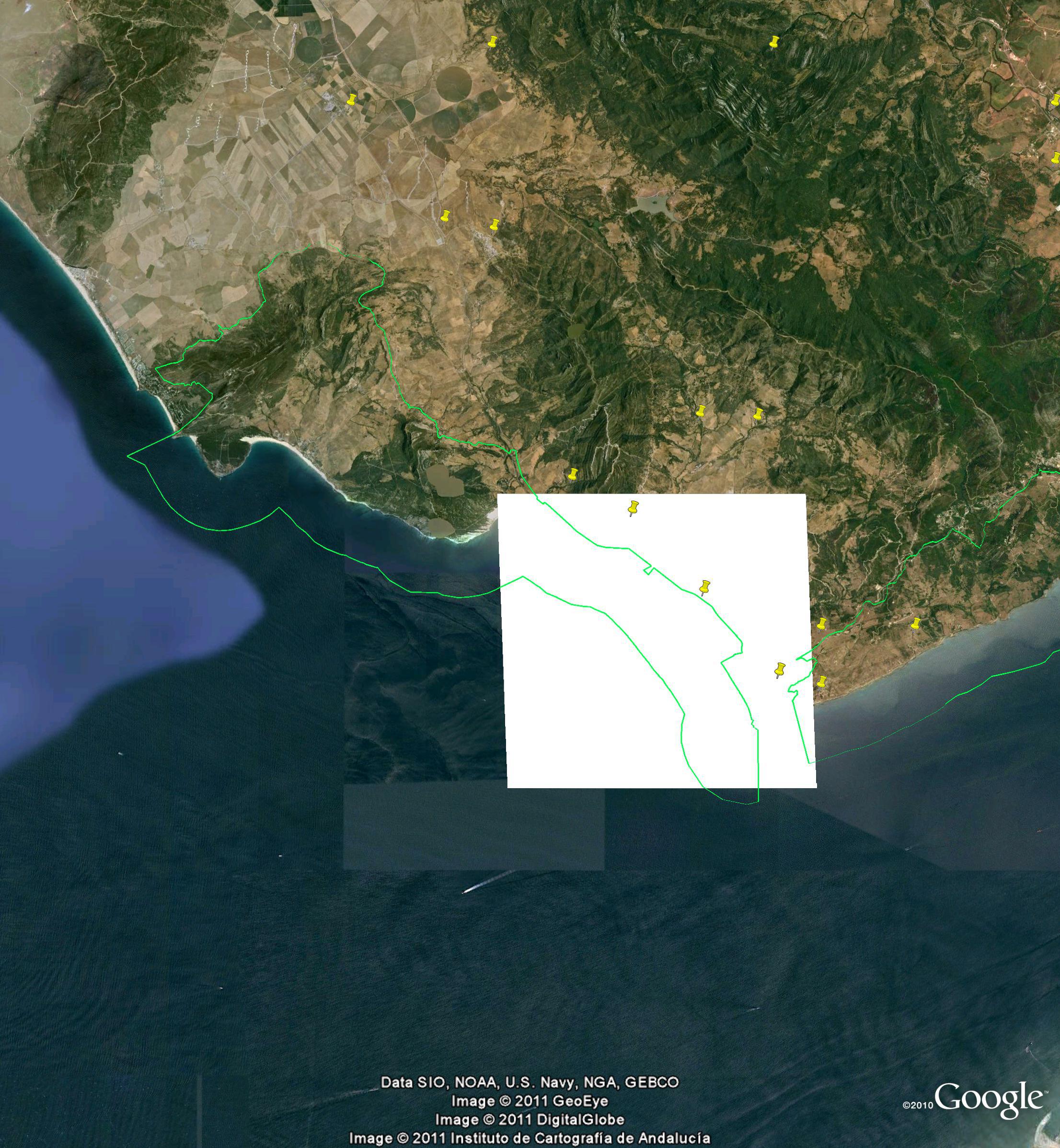
The white rectangle is all I could manage to extract from ProtectedPlanet, having gone through the pain of registering, though admittedly I’ve had better luck in the past. It could be something I’m doing wrong. The green shape I got from Natura 2000 and obviously it’s considerably better. But it still does not have the Avena, Beta, Brassica and Prunus species data in the original website AEGRO website. For that, however, it sounds like we wont have to wait for long. Jose again:
Futhermore, we will soon include the possibility of directly downloading the kmz file corresponding to each of the Google Earth plugins of each proposed site.
Hope does spring eternal.