Scientists at Warwick University’s Crop Centre have examined “96 of the world’s onion varieties” for resistance to basal rot (caused by the ubiquitous Fusarium oxysporum) and their ability to form close relationships with certain beneficial fungi. The press release doesn’t go into any detail, such as which varieties top the lists, or anything useful like that, although it does raise some questions. Like, where were the onions from? Andrew Taylor, the researcher in charge, said this:
“We have developed a unique onion diversity set from material sourced from across the globe. We now have a extremely useful library of the variation in traits … all of which will be extremely useful to growers and seed producers dealing with changing conditions and threats to onion crops.”
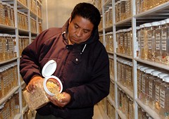
Spiffy. And a nice alternative, eventually, to current control methods. But what exactly is this “unique onion diversity set”. Is it, by any chance, anything to do with the Allium collection maintained at the old UK National Vegetable Collection at Wellesbourne, recently threatened with closure? And if so, why wouldn’t that have been mentioned by the Warwick Crop Centre, which absorbed Wellesbourne and its Genetic Resources Unit? Surely anything good that comes out of the Wellesbourne genebank is an argument for continued support.
On a purely personal note, I’d love to know whether two varieties, Up-to-date and Bedfordshire Champion, were among the 96 that were evaluated. That’s because in 1948 the UK Ministry of Agriculture Fisheries and Food noted that Up-to-date had excellent resistance to white rot, while Bedfordshire Champion was highly susceptible. In the mid 1960s, MAFF decided they were the same variety, under synonyms, and dropped Up-to-date from the National Catalogue.Wellesbourne did maintain it, and it would be interesting to know whether the two had different profiles in this latest round of evaluation.