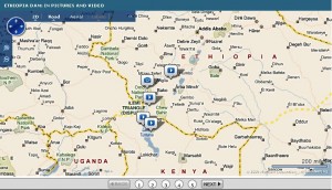
The Gibe III dam on the Omo River in southern Ethiopia will be the tallest of its kind in the world. It will generate a lot of much-needed electricity, but there are fears for its impact on the environment and (agro)biodiversity, and on the pastoralist and fishing lifeways of the peoples living downstream of it. Richard Leakey has come out forcefully against the project. The BBC puts it all beautifully in context on a map.
Revising the US Plant Hardiness Zone Map
“All gardeners are in zone denial.”
The zones in question are the U.S. Department of Agriculture’s Plant Hardiness Zones, which show where different garden species are supposed to do well. Gardeners, of course, think they know better, and will always try to push that envelope.
Anyway, the current version of the Plant Hardiness Zone Map was done way back in 1990, and needed updating. So there’s a new one coming soon. It’s bound to be different, in places very different. A whole new set of recommendations for gardeners to go into denial about.
USDA is not describing what the new map will show, but outside experts say that the trend is for zones to shift northward. “Some places have definitely warmed, although others haven’t changed at all,” says Tony Avent, owner of North Carolina-based Plant Delights Nursery and an advisor for the revision.
You can’t do much with the current map online, but the next version will be downloadable to your GIS. It will also be more sophisticated, with better data, better interpolation and better resolution (800m):
The revised map draws on 30 years of data and uses a complex algorithm to factor in other variables that affect local temperatures, such as altitude and the presence of water bodies.
Will some of the USDA’s clonal repositories (field genebanks) find themselves in the wrong zone?
Using the internet for early warning of genetic erosion
Regular readers will recognize this as a bit of a hobbyhorse of mine. Turns out I’m not alone. A guest post over at Resilience Science discusses harnessing ICTs for ecological monitoring.
Can researchers who are interested in ecological monitoring tap into these increased flows of information by “mining†the internet to detect “early-warning†signs that may signal abrupt ecological changes?
Well, if ecological monitoring, why not genetic monitoring? The health community is in the vanguard, and reaping the benefits.
…nowadays, around 60% of all early warnings of emerging epidemic emergencies that reach the WHO come from … ICT tools.
Agrobiodiversity conservation and use also stand to gain immensely, I think. We just need to take that first step.
Bhutan agricultural statistics go online
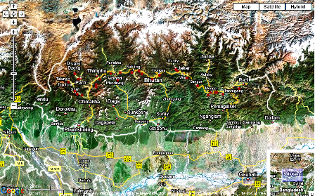
Yes, that’s what the news item said, and it got me all excited. So I rushed off to SINGER first to see if there’s any germplasm from that country in the international collections, and if any of that was geo-referenced. And I was happy to find some 30 barleys at ICARDA, strung all along the main road, from east to west.
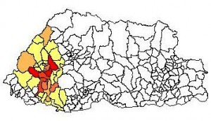
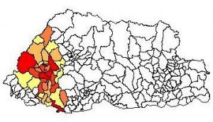
And so then I went off to CountrySTAT-Bhutan to see how well this material covered the distribution of the crop. The results were a little weird. This is the distribution of barley cultivation in Bhutan in 2005.
As you can see, the crop is concentrated in the west of the country, whereas in 1981, when the ICARDA collection was made, that seemed not to be the case. Ok, things change. The oldest data in CountrySTAT-Bhutan is 1999, but the pattern is the same.
Has the distribution of barley in Bhutan really changed so drastically in the past 30 years or so? And if so, what has that done to genetic diversity? Have the landraces formerly found in the east migrated, or are they only to be found in genebanks now?
Distributed herbarium documentation
Distributed computer projects are taking off in a big way. “Many are run on a volunteer basis, and involve users donating their unused computational power to work on interesting computational problems.” That usually means looking for extraterrestrial life or working out the structure of black holes or proteins while your computer idles away. Herbaria@home is a bit different. When you sign up as a volunteer, you receive scans of herbarium sheets, you digitize the label information, and these data are then added to the herbarium’s information system. Actually, there are other examples of such projects, which use the public’s spare brain-power, as well as their spare computer-power. I wonder if this approach could be used to improve genebank documentation. Perhaps to geo-reference tricky accessions? Or how about to characterize the morphology of different varieties from photos?