A UNEP press release about the launch of the “Kenya: Atlas of Our Changing Environment” led me to the website of the global project to which the Kenya publication contributes. It does include agriculture and aquaculture: check out the drop-down menu in the top right-hand corner. You click on the icon on the map and get more information on specific sites, such as Balanta rice farming in Guinea-Bissau, for example. You can download imagery and leave comments about each site.
Nibbles: Bananas, Sorghum, Agave, Big vs small, Cauliflower, Wine, Chestnut, Farmers’ rights, India, Aquaculture, Medicinals, Tarpan
- How they grow bananas in Fadan Karshi, Nigeria.
- How they grow sorghum in Karamoja, Uganda.
- How tequila is ruining small farms in Mexico. Or is it?
- How small farms cannot feed Africa. Or can they? Join the debate! Via.
- How the Brits plan to rebrand cauliflower. This I gotta see.
- How the ancient Chinese made wine out of rice, honey, and fruit. Pass the bottle.
- How Georgia is mapping where its chestnuts used to be.
- How farmers’ rights are being implemented.
- How Indian agriculture should move beyond wheat and rice. Ok, but what would everybody eat?
- How microsatellites can be used to help catfish breeding.
- How Ni Wayan Lilir is helping people learn about the traditional healing herbs of Bali.
- How the Brits brought back the Konik.
Nibbles: Wine, Ass, Maps, Mauka, Pest management, Photos
- Mathilda on domestication of the vine and donkey.
- New software for species mapping is out: Croziat.
- Another day, another tuber.
- Using Diversity as a Pest Management Tool. There’s a thought.
- Pix of West African plants, including cultivated, with lots of assorted link goodness.
Nibbles: Cotton, Citrus, Fig, Permaculture, Turtles, Wine, Cacao, Fish
- Wild cotton use lands prize for boffin trio.
- Unesco to protect wild Citrus in India. And read the discussion.
- IV International Symposium on Fig.
- Permaculture: The Podcast.
- The NY Times thinks Americans should eat fewer turtles. And drink more South African wine.
- Meanwile, the WSJ gets into single-source chocolate.
- Nice map of freshwater fish diversity. But will it last? WWF has a plan.
Army worms on the march
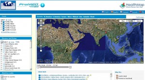
I think I may have blogged before about the ProMED-mail “global electronic reporting system for outbreaks of emerging infectious diseases & toxins.” You can get email alerts and also produce maps for plant diseases, such as this one:

Unfortunately, the system only covers infectious diseases. It is a programme of the International Society for Infectious Diseases, after all. Otherwise, it would have picked up the plague of armyworms currently affecting Liberia. A quick search of my feed reader revealed outbreaks in Namibia and Zimbabwe within the past two years. And Google Trends shows some interesting, ahem, trends in searching News archives show this timeline for news of this pest 1 over the past few years:

There’s research on natural enemies going on, but that’s not going to help Liberia right now.