Hittites “used infected sheep as biological weapon.”
African Coffee Research Network endures
Having been in at the birth of the African Coffee Research Network fifteen years ago or whenever it was, it’s nice to see them making the mainstream African press. On the other hand, the list of things they are planning to do looks remarkably like the one we came up with at the early meetings. Fifteen years ago.
Sacred cows
India has lost half its 27 cattle breeds?
New map of anthropogenic biomes
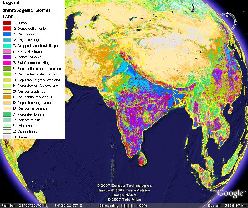
Professor Erle Ellis of the University of Maryland, Baltimore County and Professor Navin Ramankutty of McGill University have come up with a new classification of the earth’s biomes. They call the new classes “anthromes,” or anthropogenic biomes:
Anthropogenic biomes are not simple vegetation categories, and are best characterized as heterogeneous landscape mosaics combining a variety of different land uses and land covers.
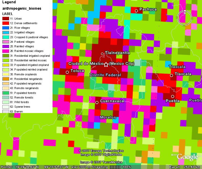
I would imagine this will be quite useful in mapping the distribution of individual crops and even crop varieties. The anthromes may be viewed in Google Earth. Here’s what South Asia looks like.
And this is the area around Mexico City.
Ethiopia and the ITPGRFA
Ethiopia’s Institute of Biodiversity Conservation (IBC) has a nice new website. Interestingly, it includes an interactive feature called BioForum. I was surprised, however, to see no reference to the Standard Material Transfer Agreement (SMTA) in the section on access. Since Ethiopia has been a Party to the International Treaty on Plant Genetic Resources for Food and Agriculture since 2003, IBC should be using the SMTA for transfers of Annex 1 material, surely.