Picking a good agrobiodiversity beach
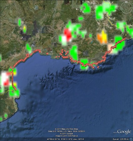
My apologies to Robert Hijmans, the developer of DIVA-GIS. I had forgotten how awsomely awesome his software. It was really only the work of half an hour to export a shapefile of the distribution of wild and weedy accessions from Genesys, open it in DIVA-GIS, produce a gridfile of taxon richness, export it as a KMZ, and open it in Google Earth, together with The Guardian’s European bathing places dataset, which I had prepared earlier.
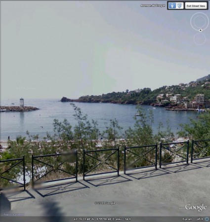
A beach called La Figueirette at Theoule-sur-Mer is right in the middle of that (relative) hotspot of species richness not far from the Italian border shown in light orange on the map above. And the beach doesn’t look too bad either, at least on StreetView.
Now, to check out the lakes…
Rice domestication roundup
In the past few weeks there’s been a number of papers on the genetics of rice domestication. I’ll just give you the main findings here, and leave you to battle with the details on your own. With the help of various other bloggers.
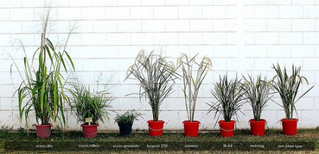
Dorian Fuller did a great job of summarizing the multiple domestication (or indica and japonica) theory at The Archaeobotanist a couple of weeks back. This seems to have the upper hand at the moment. Wild perennial rice is cultivated in wetland margins in the Neolithic Yangtze, and as the water ecology begins to be altered by humans, creating seasonal drought conditions to stimulate seed production, particular adaptations are selected (annuality, short stature, less branching etc.), which leads to the domestication of japonica rice. This is then taken to the area of an independently-domesticated proto-indica, probably around 3800-4000 years ago, and some genes are exchanged. So far, so good, and there is now a pretty comprehensive database of rice archaeology to back up the recent studies of single and multiple genes.
Well, certainly the “genetic and selective basis for domestication” seem to be different for japonica and indica, but another recent paper throws some doubt on the multiple domestication idea. Now, I’ve briefly discussed this with people who know a lot more about rice than I do and it seems the main sticking (as it were) point is the dating of the indica-japonica split to 3,900 years ago. Previous estimate were in the hundreds of thousands of years, supporting the multiple domestication theory, but the problem is that the newer, lower estimate was based on domestication genes only. Lots more argument on the horizon, I suspect.
Nibbles: Median strips, Vitamin A, Mapping in Kenya, Chaffey, Small farms, Rennell Island coconuts, Sweet potato breeding, Acacia nomenclature, Crop models, Pulque, Fruits
- Planting roadsides with natives, including crop wild relatives. And here comes the database.
- Orange Maize: The Movies.
- VirtualKenya really here. Mother-in-law beside herself.
- Plant Cuttings is out. And all of a sudden I’m in a much better place.
- Small is beautiful, farm edition. And as chance would have it, coffee farm edition. And urban edition.
- Dispute at iconic coconut plantation resolved. Apparently there are some really unique varieties there.
- I say boniato. For the first and last time.
- Acacia on the brink. Easy, tiger. The name, not the genus.
- We’re going to need a better model.
- Pulque comes back. Never knew it had gone away.
- Domesticating fruit trees in Kenya. Something for VirtualKenya?
Mapping Australian biodiversity
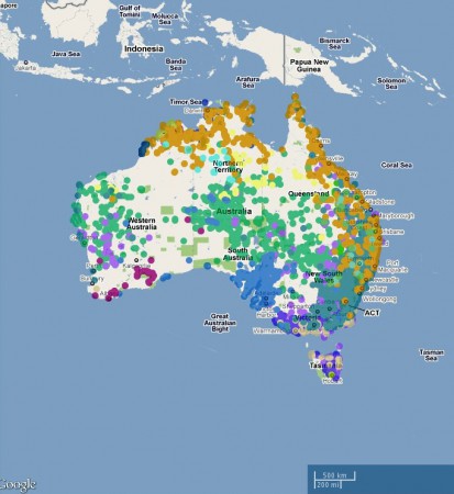
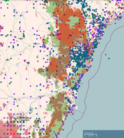
I finally got around to having a go at the Atlas of Living Australia. Very nice. You can make, and download images of, pretty maps of species distributions, Glycine in this case.
And you can mash that up with lots of different environmental layers, such as protected areas, as below.
There are nifty spatial analysis tools built in, to help you predict species distributions based on climate, for example, or explore the range of adaptation of a taxon. You can contribute to the data through citizen science projects. And much more. Well worth exploring.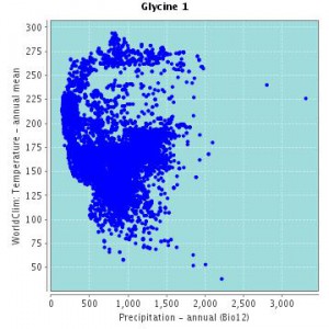
What you can’t do — or at least I couldn’t find a way of doing it — is export the species distribution data to a kmz for use in Google Earth. Something I’ve complained about before for other biodiversity portals. Maybe someone out there will tell us why that is. 1
One final thing. It’s a great idea to feature a number of “themes” on the atlas website, to get people started. At the moment it is things like wattles, “iconic species” and ants. Why not crop wild relatives?
