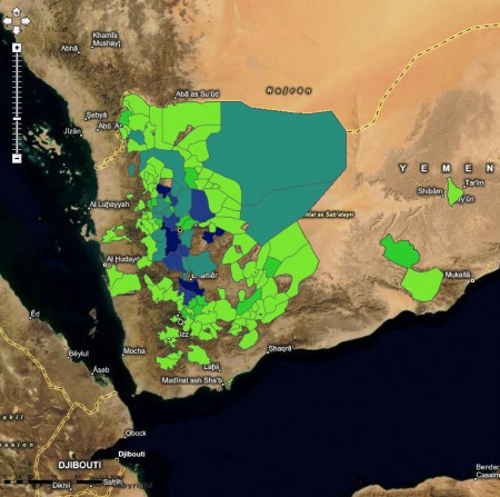
For what it’s worth, I have enormous admiration for IFPRI and its products. Not that they give a damn about that, but I just want to get it out of the way before slamming them. First, the news item on a new interactive atlas of food security in Yemen doesn’t have a link to the new interactive atlas of food security in Yemen. Not to worry, though, Google is your friend, 1 and it’s not all that difficult to find the relevant page on the IFPRI website. But then the new interactive atlas of food security in Yemen turns out to be nice enough as to content, but highly frustrating to use. No way to download or export maps. I had to get the thing below (showing barley cultivation, for the record) through a screen grab. Yuch.
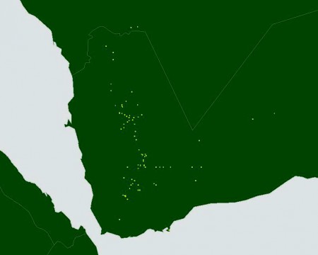
And no way to mash up the results with other stuff. Like, for example, barley accessions in Genesys. Which in contrast you can export in a number of ways.
Oh, sure, there are some words of explanation, if not excuse:
The online version does not require installing software but it is more limited in the sense that the underlying data cannot be accessed by the user (unlike in the case of the download of the data package).
But I don’t believe it would be that difficult to allow some sort of exporting online. Maybe I’m wrong. Someone tell me, please.
So, anyway, two maps which cry out to be looked at together, for example in Google Earth, and no way of doing so, at least that I can see. As I say, very frustrating. Who do I complain to? There someone in the CGIAR to whom I can go with a query about spatial data, right? Isn’t there?


This is the CGIAR Dude you want, Dude. He’s “always been fascinated by maps”.
I’ll drop him a line, he seems an affable young man.
Hi Luigi, thanks for your interest!
We’re still working on the Yemen Food Security Atlas, and we have been experimenting various platforms to find the best one online. The one you ran into from Google was one of such experiments, not supposed to be the final product. In this one, we just used the ArcGIS Server’s out-of-box web application, but we found several limitations as you described. We were not happy either, so we started looking for other options.
Now, as a new approach, all layers in the Atlas are being published through ArcGIS.com (for example, see http://goo.gl/DLIA3), and they will be all publicly available. You can then readily mash-up with your own data on your application.
Using those layers, we’re building a new one at http://yemen.mappr.info (not publicly released yet, but feel free to browse through the layers we’ve got so far).
If you have any further question/comment, please contact Jose Funes (j.funes@cgiar.org) at IFPRI.
Cheers,
Jawoo
Thanks for this, Jawoo, I very much appreciate you taking the trouble to get back to me. Unfortunately, I cannot get the system to do what I want it too, easily, yet. So I will await further developments.
The nice thing of the Yemen map is the union between generated maps and Google’s maps. Having either a satellite image in the background or an elevation map puts the dots or shapes in context; you could also play with transparency.
Agreed, being able to plonk the generated map on top of Google’s maps is cool. My point is that what I’d like to be able to also do is: (1) download at least an image of the result; and/or (2) export a kml (or import data from other sources), so that I could look at the result in conjunction with other stuff. My assumption was that this would be fairly easy to do technically, but Jawoo seems to disagree. Anyway, it looks like IFPRI are working on improvements.
Luigi (and readers of this blog),
Let me first say that the Yemen Atlas is available as a disk package coming with a complete set of data files, viewer program, and documentation. You can download it all from IFPRI’s website at http://www.ifpri.org/publication/digital-food-security-atlas-yemen
If you’re serious about mapping and using them in your own product beyond the exploration of data behind the maps, I think you should request the CD package and use it in your GIS software, not the web-based version. This online version you’re questioning is just another way of accessing the data, and it’s still under development.
The platform we’re now using (ArcGIS.com – there are 12 basemaps to choose from, by the way) provides a much better functionality than the first one, but it still doesn’t let you download your map as an image file. Exporting in KML and changing opacity of layer are already possible though – we’re planning to create a walk-through videoclips to show how to do these.
Thanks,
Jawoo
Again, many thanks for this. My difficulties are more illustrative of my ignorance of all this than anything else.