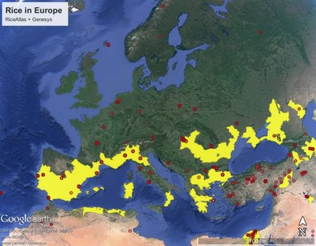
A little more on that RiceAtlas that I blogged about a couple of days ago. I managed to download the shapefile of rice growing areas, and open it in Google Earth. I then imported the Genesys rice dataset, and zoomed in on Europe. Here’s what those two things together look like.

Definitely a few issues. I’m not too worried about the accessions in northern Europe. Those are probably just wrong passport data. But what about all those in Turkey which are also outside putative rice growing areas? Are those passport data mistakes too, or is RiceAtlas missing something?