So, three years back, I posted about the floods in Pakistan, and how genebanks could potentially help farmers recover any crop diversity they lost because of them. But wouldn’t it be even better if the danger of flooding could be predicted? That way crop diversity from at-risk areas could be collected, if not already in genebanks, and multiplied up ready to be distributed should disaster strike.
Well, a recent paper does just that, using AI, no less: “We use our model predictions to identify historically flood-prone areas in Ethiopia and demonstrate real-time disaster response capabilities during the May 2024 floods in Kenya.”
I’ve managed to geo-reference a screen grab of the Ethiopia map provided in the paper using MapWarper, import it into Google Earth, and add the locations of sorghum landraces as reported in Genesys. Here’s what I got.
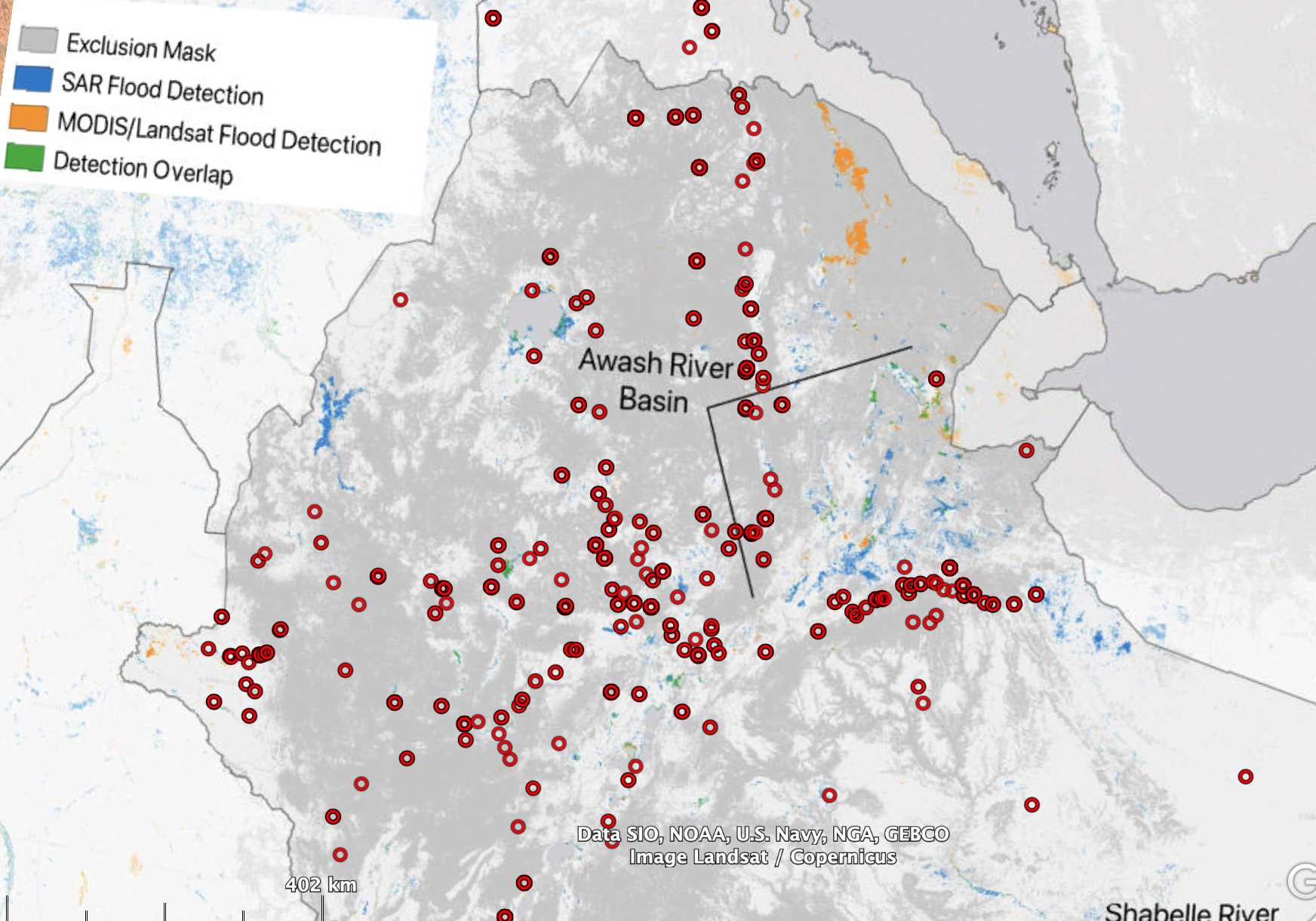
Unlike in the Pakistan example, there’s not much in the way of genebank accessions from areas of Ethiopia that are particularly at risk from flooding, it seems from this. However, Genesys does not (yet) include geographic provenance data for sorghum from the national genebank of Ethiopia. The 4000-odd sorghum accession from Ethiopia currently in Genesys are conserved at ICRISAT.
It is difficult to understand the danger of flooding the Ethiopian national genebank in Addis Abeba as is is potioned at a slightly sloping site that, in my opinion, is not flood prone!?
I’m not talking about the danger to the genebank, but rather to in-situ material. Sorry for the confusion.