Sometimes it pays to spend some time in Genebank Database Hell, if you can fight through the pain.
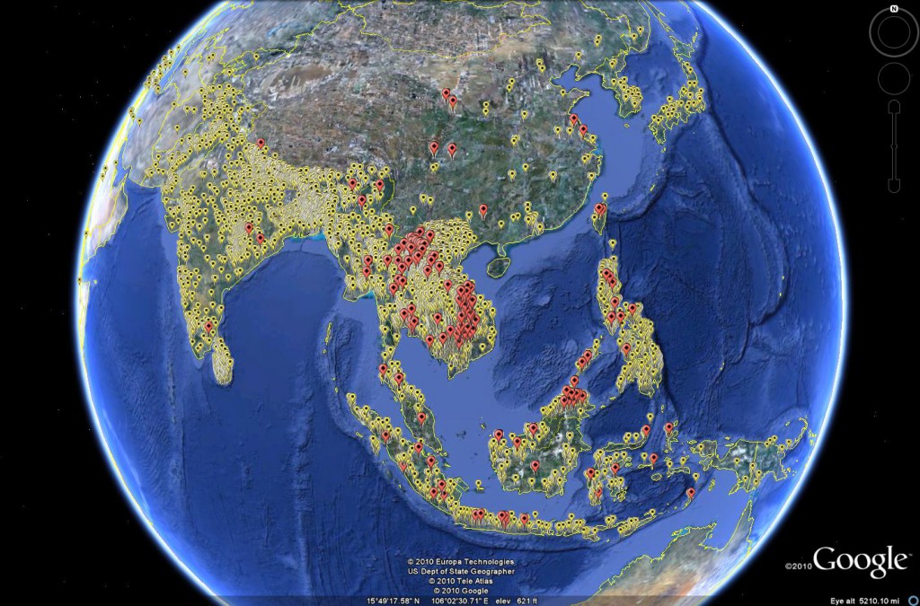
You may remember a piece recently about the antioxidant properties of black rice. But where does black rice come from? Well, hanging around with the Genesys and GRIN-Global crowd in the past couple of days has allowed me to come up with this map in answer to that deceptively simple question.
In yellow are all the rice accessions from Asia which have coordinates, as recorded in the IRRI database, EURISCO and GRIN. In red are the black rice accessions.
You’d have thought such a map would be pretty easy to make. But you’d be wrong. I had to get an Excel spreadsheet from IRRI with the characterization data, 1 and mash it up with the passport data in Genesys for the same accessions, and then export two separate kmz files and fiddle around in Google Earth. 2 Well, they don’t call it Genebank Database Hell for nothing. But it is getting better, slowly but surely.
