Good thinking by the Round Table on Responsible Soy (RTRS) to map where it is most — and least — environmentally responsible to extend soy cultivation in South America.
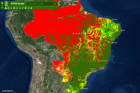
“An interesting exercise, isn’t it?” they ask. No doubt it was meant rhetorically, but I’ll answer anyway: definitely, you bet! But how much more interesting if there had been a way of adding your own data to theirs. I’d really like to know, for example, about any crop wild relatives found in those light green areas in particular: “Areas where existing legislation is adequate to control responsible expansion (usually areas with importance for agriculture and lower conservation importance).” I know where to get the CWR data. 1 But how do I mash them up with this?