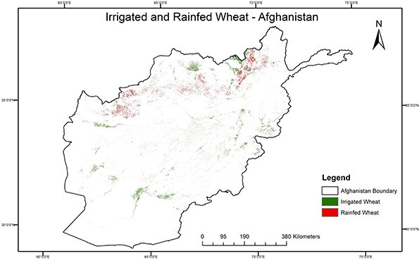
There’s a new paper on the geographic distribution of wheat cultivation in Afghanistan. You can explore the data online. But here’s the bottom line, the paper’s Fig. 9.
I downloaded the cultivated wheat data from Genesys and imported everything into QGIS to play around with. That’s almost 5,000 genebank accessions, about half of which are geo-referenced. Here’s the result.
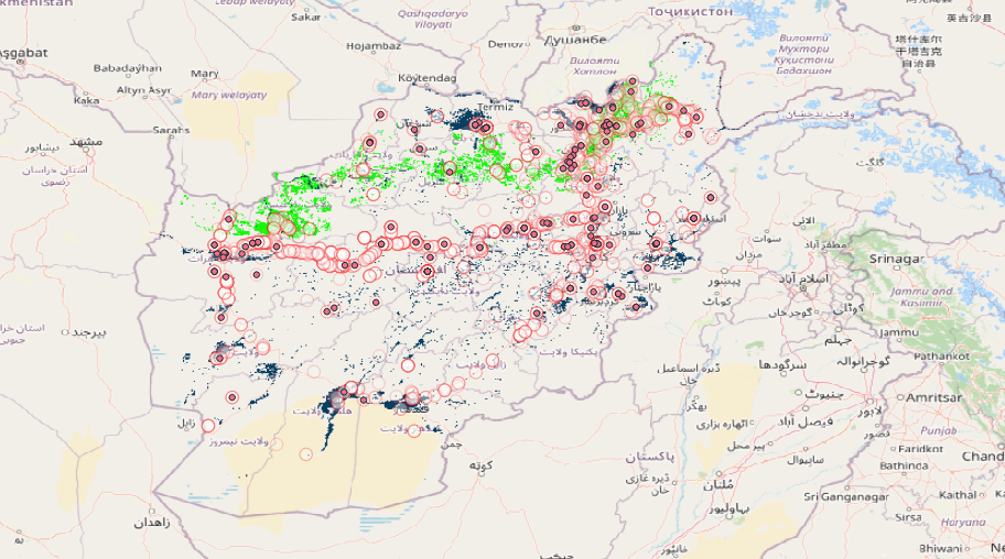
Circles are all cultivated wheats, red dots everything that is not bread wheat. Note the irrigated areas (dark blue) are more likely to have modern varieties, and that the area of rainfed cultivation (bright green) varies considerably from year to year with precipitation. Probably some more collecting to be done then, in particular in the rainfed northwestern region, based on this map. But I’m not going to bet on that until I see whereVIR’s 570-odd Afghan wheats were collected.
Why isn’t the VIR collection georeferenced yet? The information for the collections sites appears to be available on paper records. Is that a funding or political problem?
I think it may well be geo-referenced and digitized. It’s just that the data are not available online. No idea why.