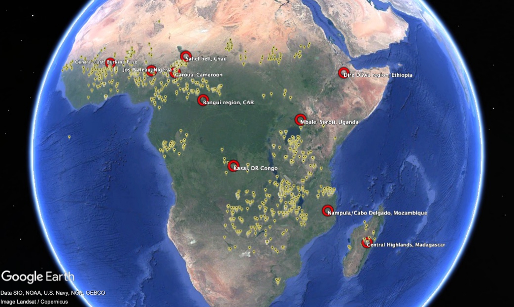
Yesterday’s Nibble on the annoyingly always-on-the-verge-of-breaking-through Bambara groundnut had me rummaging through the blog’s archives. Among dozens of references, I came across a post from almost 15 years ago that included some maps — of genebank accession localities and the distribution of the crop. On a whim, I downloaded the Genesys data and fed it into the maw of ChatGPT, asking it to identify gaps in the world’s ex situ holdings. For each of the top 10 priority collecting regions, I then asked for a best-bet locality for exploration. ChatGPT obliged with a KML file, which I then looked at in Google Earth, together with the accession localities.
This is the result.
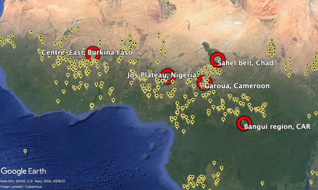
And here’s close-up on West Africa, because that’s where accessions are densest, and the suggested “gaps” a little more difficult to understand.
Asked for a justification, this is what the LLM came up with.
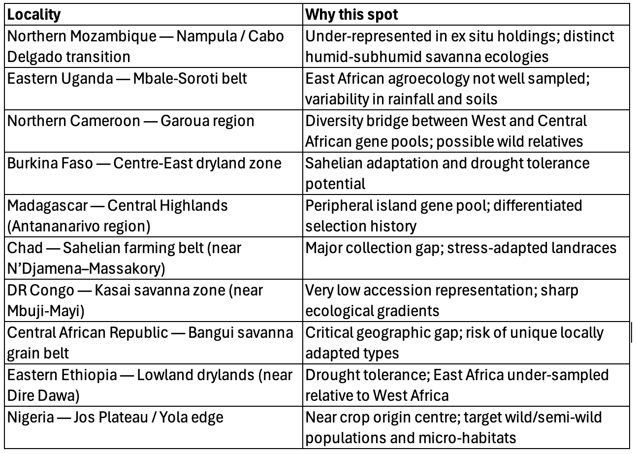
Does it make any sense? Well, it’s not exactly where I would have plumped for, just eyeballing the data. But it is not complete nonsense. Maybe it was the prompt? Any ideas what that should look like to get the best results?
Not that any of this is going to help Bambara groundnut much, I suspect.
I still maintain that the Bambara groundnut doesn’t want to be saved. We’ve given it enough chances Shirley.
Agreed. And don’t call me Shirley.