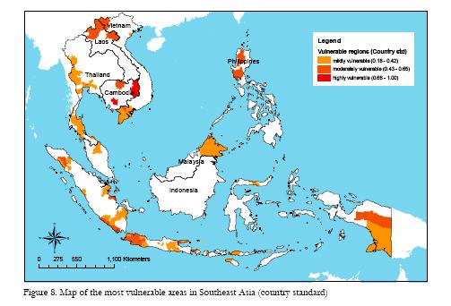
The International Development Research Centre’s Economy and Environment Program for South-East Asia (EEPSEA) has just published a study on the effects of climate change on SE Asia. The authors first mapped climate hazard, including all kinds of different things, from drought to cyclones to sea level rise. They then compared that with maps of population density and adaptive capacity. That allowed them to identify a number of vulnerability hotspots. And here they are, the most vulnerable areas in each country:
All good places in which to start looking for agrobiodiversity to collect for ex situ conservation before it disappears, and in which to test agrobiodiversity for its possible contribution to adaptation.

Andy has maps of Dipterocarp vulnerability in this self-same area. Mash ’em up, I say.