I know what you’re wondering. You’re wondering whether those fires in Indonesia which are causing so much trouble with haze in Singapore and other neighbouring places are also endangering any crop wild relatives back home. Well, thanks to the following Twitter exchange with the GIS people at Kew, I now know (or have been reminded, actually) that NASA makes available global data on active fires:
@AgroBioDiverse @worldresource yes with GeoCAT & kml layer import – this is from last 24 hrs http://t.co/3utE5w6cMb pic.twitter.com/RqtpAIsm0n
— KewGIS (@KewGIS) July 10, 2013
We can of course mash that up in Google Earth with, say, the distribution of wild rice (Oryza spp) from Genesys. That would be the little pale blue circles in the map reproduced below.
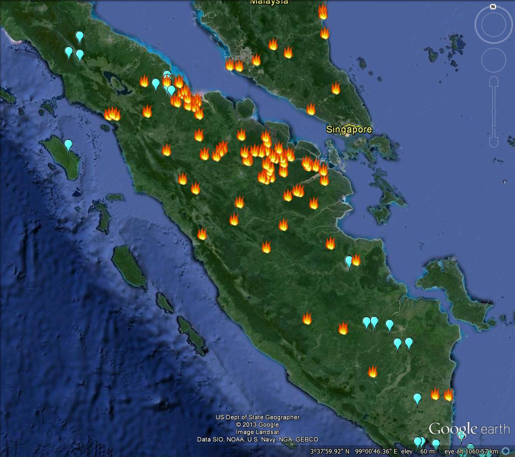
Which does suggest that at least some of the Indonesian fires may be occurring in wild rice habitats. They may actually be beneficial to some of the weedier species, though, for all I know. Anyway, as ever, it’s nice to have the data. And, just as importantly, be able to play with it.
Are wildfires a real, severe threat to CWR around the world? If it is the case, why not put resources into building an automated simple GIS that combines the two layers, draws a buffer around each fire and sends message when a CWR stands within that distance from a fire?
Someone would need to read the message and act upon it, yes. Like updating the databases with a note so others would know about a recent fire. Actually while I’m at it, I’d automate that too, and only a weekly report on spots that were threatened by wildfires.
Work by CGIAR-CSI staff just won them an award. They should not rest on their laurels.
How can I submit an announcement to the greater agro-biodiveristy community through this network? Great blog by the way. Thank you.
Edward Silva
There is a contact form in the menu; please use that.