Looks like mapping is in the air. Hardly had I finished messing around with European trees maps that I ran across this random dump of Brazilian crop distribution data. The source is given as the Brazilian Institute of Geography and Statistics (IBGE), but I was not able to find the original maps there. I still wanted to do a mashup with Genesys, though, of course, which meant a little more messing around.
In the end, it turned out to be fairly easy, though not as easy as with those EUFGIS shapefiles. You have to hack the map off that first website as a screenshot, then add the JPG as an image layer in Google Earth and tweak the corners until it more or less fits on top of the borders of Brazil, which is the bit that takes time. Once you’re happy with the fit, you can download an appropriate KML file from Genesys and plonk it on top. Here’s the result for cassava (click on the image to see it better).
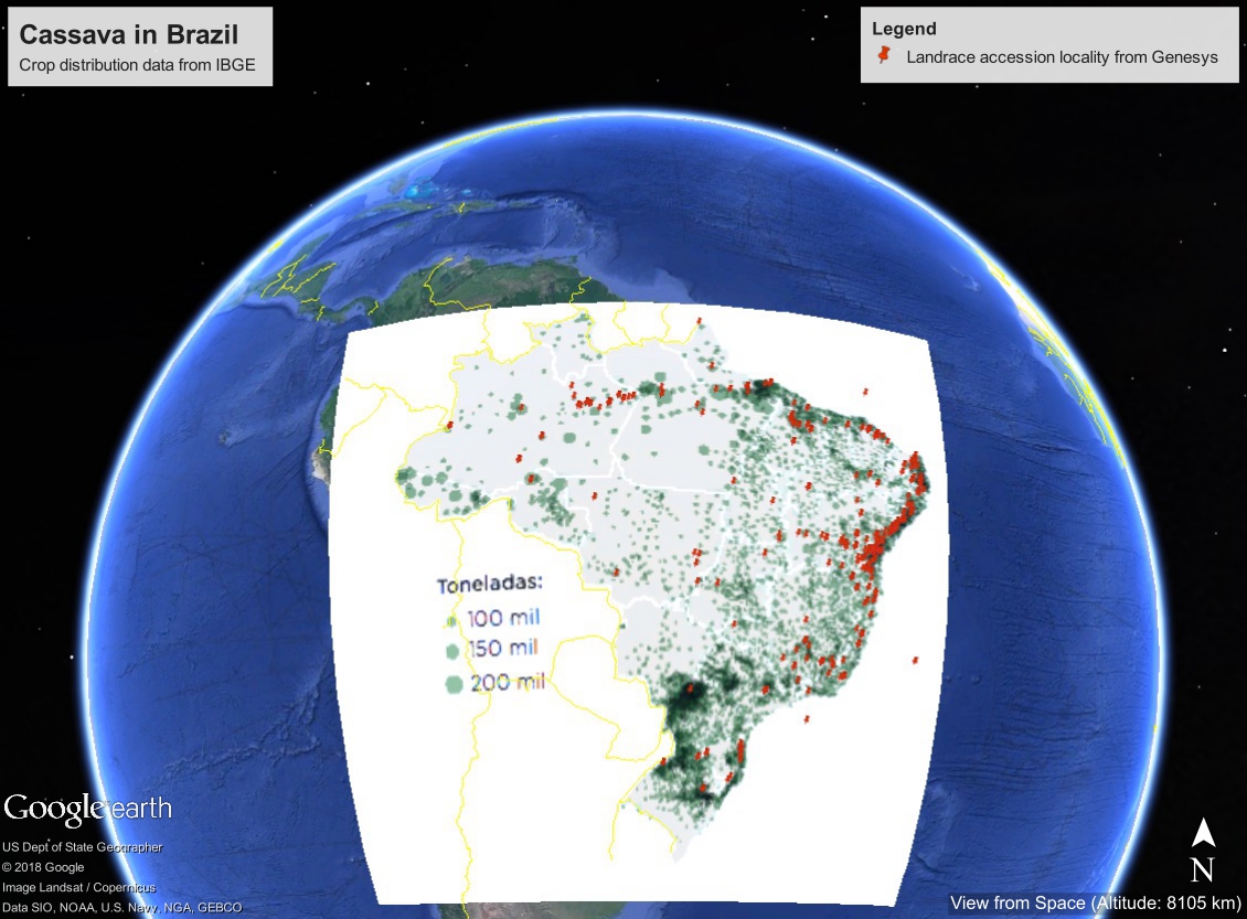
The green splodges mean cassava cultivation according to IBGE, and the red dots are cassava landrace accessions from Genesys. That would be a pretty good way to identify gross geographic gaps in ex situ holdings, but for the fact that, crucially, there’s no data from the national collection at Cenargen in Genesys. Yet. We’re working on it. Stay tuned.