As regular readers know all too well, I can’t resist a map mashup. So when I saw the latest data on deforestation in the Amazon, I fired up MapWarper and GoogleEarth and got to work.
And here’s a look at how recent deforestation in Brazil relates to the localities of past cassava collecting, at least as far as Genesys knows about it.
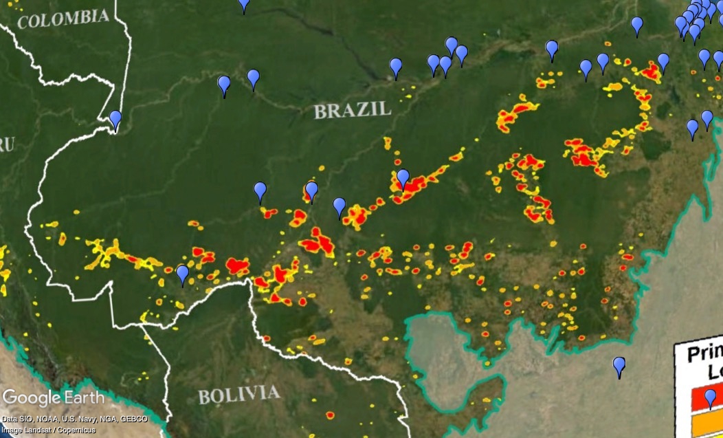
Now, I don’t know in what way deforestation (and associated disruptions) relates to loss of cassava diversity, but there’s a chance that it might. Could make an interesting PhD project for someone.
Anyway, encouraged by my pretty result, and remembering that I wanted to do something with some shiny new maps I had heard about, I next mashed up sorghum accessions and poverty in Burkina Faso. Here’s what I got.
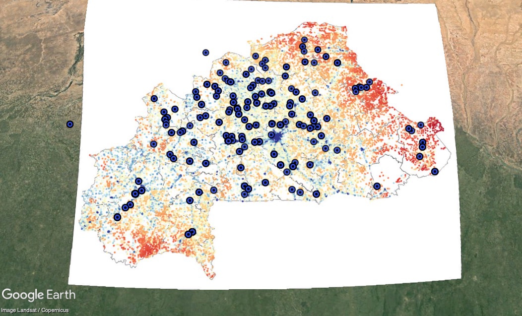
What’s going on? Why are there relatively fewer sorghum accessions where poverty is higher (more red)? Are those places just harder to reach? Or do people there really grow less sorghum.
Again, I don’t know. But I think it would be interesting to find out.
All speculation welcome in the comments.